Log in
All resources
Create a design
925 Free Images of Nautical Chart
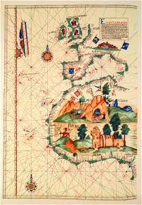
lawrence h. slaughter collection of english maps, charts, globes, books and atlases
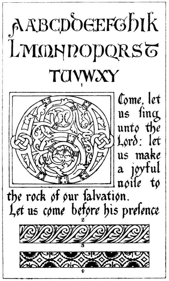
latin alphabet charts
portolan charts by willem and johannes blaeu
les forces de l'europe, asie, afrique et amerique, ou description des principales villes, avec leurs fortifications
portolan charts made in the 18th century
maps in the rijksmuseum amsterdam
maps of north america
portolan charts made in the 17th century
nypl lionel pincus and princess firyal map division
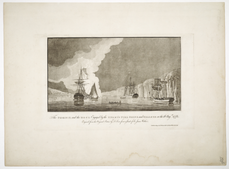
copper engravings
charts and maps of the royal museums greenwich
1590 maps
astronomicum caesareum
lunar eclipse charts
avatar (2009 film)
avengers: endgame
charts and maps of the royal museums greenwich
1777 maps of new york (state)
harper's magazine, 1861
engravings
harper's magazine, 1861
engravings
1747 engravings
compass roses
ausgangsschrift / pictures by user:der barbar
sütterlin latin alphabet charts
ludwig sütterlin (graphic artist)
latin alphabet charts
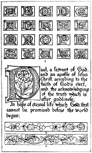
latin alphabets as initial
latin alphabet charts
portolan charts made in the 17th century
maps by willem and johannes blaeu
the fables of æsop (jacobs, heighway)
pedigree charts
1747 engravings
compass roses
charts and maps of the royal museums greenwich
1778 maps of new york (state)
diagrams of krkonoše mute signs
symbol charts
catalan atlas, 1959 reproduction
coats of arms on maps
postcard production
color charts
postcard production
color charts
postcard production
color charts
sütterlin latin alphabet charts
handwriting
portolan charts by willem and johannes blaeu
old maps of holland
lawrence h. slaughter collection of english maps, charts, globes, books and atlases
nypl lionel pincus and princess firyal map division
portolan charts by willem and johannes blaeu
copper engravings
naval flags of the batavian republic
flag charts of the netherlands
latin alphabet charts
german renaissance
portolan charts by willem and johannes blaeu
1620s maps of the atlantic ocean
latin alphabet charts
johann theodor de bry
woodcuts by albrecht dürer, 1489-1500
german renaissance
portolan charts by willem and johannes blaeu
old maps of holland
sturm und drang,weimar classicism,age of enlightenment
johann wolfgang von goethe
codex vallardi - drawings by pisanello
veronese school,renaissance
portolan charts by willem and johannes blaeu
old maps of friesland
french presidential election (1974)
romanticism,orientalism
latin alphabet charts
german renaissance
woodcuts in the rijksmuseum amsterdam
jan christoffel jegher
woodcuts in the rijksmuseum amsterdam
jan christoffel jegher
lawrence h. slaughter collection of english maps, charts, globes, books and atlases
de nieuwe en onbekende weereld
old maps of french guiana
1630s maps of brazil
maps of the republic of venice
17th-century maps of istria
chromolithographs in the rijksmuseum amsterdam
symbolism
carta hydrographica y chorographica de las yslas filipinas
baroque painting
maps of ven (oresund)
old maps of skåne
17th-century maps of the mediterranean sea
portolan charts made in the 17th century
16th-century maps of guyana
old maps of french guiana
1620s maps of the iberian peninsula
maps by willem and johannes blaeu
chromolithographs in the rijksmuseum amsterdam
symbolism
diagrams, plots and charts from the british library mechanical curator collection
a treatise on ore deposits (1896)
soviet posters of the civil war of russia
cyrillic alphabet charts
flag charts of romania
flags of moldavia
naval flags of the batavian republic
flag charts of the netherlands
lawrence h. slaughter collection of english maps, charts, globes, books and atlases
atlas novus (blaeu)
lawrence h. slaughter collection of english maps, charts, globes, books and atlases
atlas novus (blaeu)
lawrence h. slaughter collection of english maps, charts, globes, books and atlases
atlas novus (blaeu)
1670s maps of the iberian peninsula
hugo allardt
nuevo atlas o teatro mundo
old maps of the arctic
maps from the earth and its inhabitants, vol. iv
charts of plymouth sound
diagrams, plots and charts from the british library mechanical curator collection
a class-book of modern geography (1898)
14th-century illuminated manuscripts from spain
jong (ship)
lawrence h. slaughter collection of english maps, charts, globes, books and atlases
1700 maps of the atlantic ocean
lawrence h. slaughter collection of english maps, charts, globes, books and atlases
1700 maps of the atlantic ocean
lawrence h. slaughter collection of english maps, charts, globes, books and atlases
novi belgii, atlas maior
photographs in the museum of modern art
johann palisa
chromolithographs at boston public library of flags and arms
louis prang & company
indiana jones and the temple of the forbidden eye
dinosaur (disney's animal kingdom)
civil ensigns in the ottoman empire
flag charts of turkey
portolan charts made in the 17th century
maps by willem and johannes blaeu
prints by heinrich aldegrever in the rijksmuseum amsterdam
the illustrated bartsch 241–250
portolan charts by willem and johannes blaeu
dutch east india company
lawrence h. slaughter collection of english maps, charts, globes, books and atlases
de nieuwe en onbekende weereld
lawrence h. slaughter collection of english maps, charts, globes, books and atlases
1640s maps of the americas
lawrence h. slaughter collection of english maps, charts, globes, books and atlases
1700s maps of north america
ornament prints printed by martin engelbrecht
latin alphabet charts
17th-century maps of the mediterranean sea
portolan charts made in the 17th century
lawrence h. slaughter collection of english maps, charts, globes, books and atlases
nypl lionel pincus and princess firyal map division
lawrence h. slaughter collection of english maps, charts, globes, books and atlases
pre-raphaelite brotherhood
drawings by antoon derkinderen in the rijksmuseum amsterdam
symbolism
lawrence h. slaughter collection of english maps, charts, globes, books and atlases
covens en mortier
galicia (spain) in the 1390s
galicia in portolan charts
european exploration of africa
portuguese empire
lawrence h. slaughter collection of english maps, charts, globes, books and atlases
covens en mortier
lawrence h. slaughter collection of english maps, charts, globes, books and atlases
covens en mortier
openseamap icons
pd textlogo
lawrence h. slaughter collection of english maps, charts, globes, books and atlases
maps by claude joseph sauthier
lawrence h. slaughter collection of english maps, charts, globes, books and atlases
nypl lionel pincus and princess firyal map division
pen and pencil sketches; being reminiscences during eighteen years' residence in bengal (1883)
diagrams, plots and charts from the british library mechanical curator collection
lawrence h. slaughter collection of english maps, charts, globes, books and atlases
maps of nieuw nederland
les forces de l'europe, asie, afrique et amerique, ou description des principales villes, avec leurs fortifications
portolan charts made in the 18th century
les forces de l'europe, asie, afrique et amerique, ou description des principales villes, avec leurs fortifications
portolan charts made in the 18th century
les forces de l'europe, asie, afrique et amerique, ou description des principales villes, avec leurs fortifications
portolan charts made in the 18th century
les forces de l'europe, asie, afrique et amerique, ou description des principales villes, avec leurs fortifications
portolan charts made in the 18th century
les forces de l'europe, asie, afrique et amerique, ou description des principales villes, avec leurs fortifications
portolan charts made in the 18th century
les forces de l'europe, asie, afrique et amerique, ou description des principales villes, avec leurs fortifications
portolan charts made in the 18th century
les forces de l'europe, asie, afrique et amerique, ou description des principales villes, avec leurs fortifications
portolan charts made in the 18th century
les forces de l'europe, asie, afrique et amerique, ou description des principales villes, avec leurs fortifications
portolan charts made in the 18th century
drawings in the rijksmuseum amsterdam
pieter van looij
ismailïa. a narrative of the expedition to central africa for the suppression of the slave trade (1874)
diagrams, plots and charts from the british library mechanical curator collection
history
theory
lawrence h. slaughter collection of english maps, charts, globes, books and atlases
nypl lionel pincus and princess firyal map division
lawrence h. slaughter collection of english maps, charts, globes, books and atlases
covens en mortier
history
theory
801 - 900 of 925
Next page
/ 10


![Novi Belgii, quod nunc Novi Jorck vocatur, Novae q[ue] Angliae & partis Virginiae: accuratissima et novissima delineatio., 1671](https://cdn.creazilla.com/illustrations/10000934523/novi-belgii-quod-nunc-novi-jorck-vocatur-novae-que-angliae-partis-virginiae-accuratissima-et-novissima-delineatio-1671-md.jpg)